Santa Bárbara (Santa Bárbara)
 |
Santa Bárbara was created on 29 September 1882 by decree 21.
Santa Bárbara was originally populated by the Huetares, who lived in the Barva region. When the Spanish settled, the Huetares were forced to work on Spanish haciendas where many crops were produced, including corn, beans, legumes, cotton, sugarcane, and sarsaparilla.
While looking for an outlet to the Caribbean Sea, Joaquín Mora Fernández (not to be confused with the future president), conducted the first documented European explorations of the area. Mora Fernández established a base within the general area of the canton.
The first haciendas in the area are dated to January 19, 1663, when Joseph Sandoval Ocampo, among others, was given a farming and pasture concession from the capital city of Cartago.
By the time Alajuela was founded in 1782, the present district of San Pedro, which were then collectively called Targuás or Targuases, are mentioned. At the time, there were seventy-six men and sixteen women in Targuás.
The name of the San Pedro district name is mentioned in 1819, according to a government document that states Juan Pablo Lara purchased land in the district on which to build a home and a farm.
Two years later, Churruca (also known as Surruco) is mentioned in documents from 1821. Churruca was the name of the Santa Bárbara canton before it took the current name. According to a local legend, Santa Bárbara was chosen for the region's patron saint because a resident bought an image of Saint Barbara from a Franciscan and made an altar in her home. During a terrible rainy season in Santa Bárbara, Saint Barbara heard the prayers of the resident. Little by little, her neighbors became convinced of that Saint Barbara was answering her prayers.
The canton was established by a government resolution of October 3, 1855.
Some of the early residents of Santa Bárbara include Ambrose Arias, Juan Cortez, Andres Murillo, Gregory Cuadra, Salvador Sanchez, Jose Maria Palma, Juan Bastos, Victorio Cortes, Joaquin Gutierrez, Jose Angel Sanchez, Jose Dolores Gonzalez and Diego Murillo.
Map - Santa Bárbara (Santa Bárbara)
Map
Country - Costa_rica
 |
 |
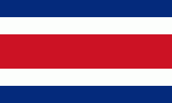
| Flag of Costa Rica | |
The sovereign state is a unitary presidential constitutional republic. It has a long-standing and stable democracy and a highly educated workforce. The country spends roughly 6.9% of its budget (2016) on education, compared to a global average of 4.4%. Its economy, once heavily dependent on agriculture, has diversified to include sectors such as finance, corporate services for foreign companies, pharmaceuticals, and ecotourism. Many foreign manufacturing and services companies operate in Costa Rica's Free Trade Zones (FTZ) where they benefit from investment and tax incentives.
Currency / Language
| ISO | Currency | Symbol | Significant figures |
|---|---|---|---|
| CRC | Costa Rican colon | â‚¡ | 2 |
| ISO | Language |
|---|---|
| EN | English language |
| ES | Spanish language |


